Broomhill is part of the North Downs ridge of
chalk that finishes on the Hoo Peninsular and was formed in the cretaceous
period. Archaeological evidence indicates that there has been human activity on
the hill since the Stone Age: Remains of
ancient flint mines have been found and it continued to be mined until the late
19th century. At Piper’s House Farm there is evidence of the chalk
pits being used as refuges by Ancient Britons when under attack. Chalk was
quarried at Broomhill from Roman times until the last quarry was closed in the
middle of the 20th century. Through the ages the chalk has been used not only
for building and cement production but also, from the Middle Ages until the
late 19th century, for making lime.
(Records show several 19th
century lime kilns on the hill.)
Through history, the summit has been used
strategically in battle: In the Roman
colonization of AD43 the Cantii (Kentish British Tribes) inhibited the Romans
crossing the Medway at Rochester, using look out posts positioned on
Broomhill. Again, in 1264 Simon de Montfort, Earl of Leicester and
leader of the 2nd Barons’ uprising, used Broomhill to plan his strategy for
capturing Rochester Castle. Broomhill then played a key part in the 1554 Thomas
Wyatt rebellion. It was a crucial beacon in the Spanish Armada early-warning beacon
network from Southeast coastal points to London. During the 17th
century Civil War, When the Cavaliers eventually forced Cromwell's Roundheads out
of Rochester Cathedral they fled over Broomhill to Gravesend.
An Anglo-Saxon grave was found on the site which
contained a spearhead, knife and bronze ring set with an amethyst which can be
seen in Rochester Museum. Also
found on the hill have been the skeletons of the sailors and inhabitants of
Strood buried during the spotted fever out break in 1657.
In the late 18th early 19th Century
navvies tunnelled under the hill to construct a tunnel for the Thames and
Medway Canal. The canal never made a profit and was eventually sold to the
railway company It was drained and is now used as the railway line from Strood
to Gravesend. Turner and Hogarth both drew and painted views of and from Broomhill.
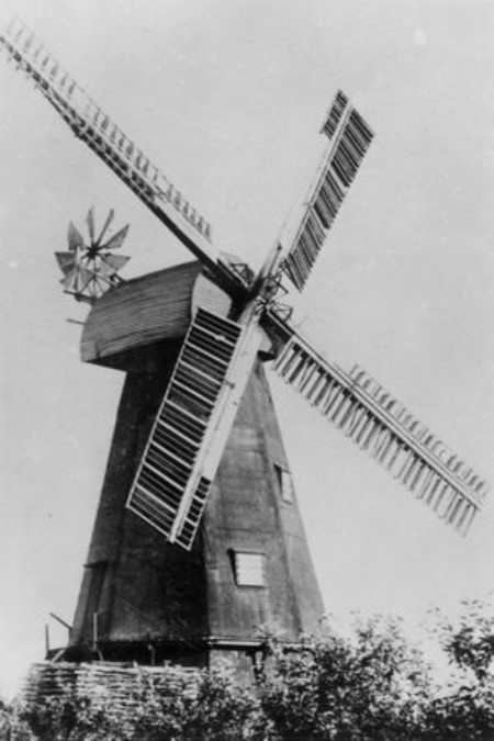
There were windmills on Broomhill from the Middle
Ages' 'Post Mills' to the early 20th Century. During the 19th Century there
were at least six. The owner of Field's Mill was an amateur musician. He
kept a piano, a harp, and a barrel organ in his sitting room. It is said that
the Organ was bought from Loose Church, and so fixed that the power from the
mill turned the organ's handle. Dickens would visit the Mill on his walks and
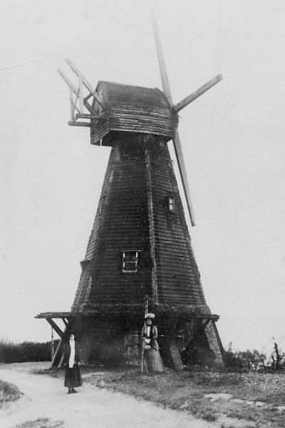
listen to the organ music. Fields Mill burnt down in 1875. Another was Killick's Mill was built in 1819. (This
had 6 sides as opposed to the more usual
8-sided mills.) The cap was blown off for the second time in 1880. It was
replaced and worked again for a year in 1890 but was unprofitable and so stood
derelict until it was pulled down in the 1920s. In the First World War a German
spy was arrested for photographing ships in the Dockyard from one of the mills
on Broomhill. The artist Evelyn Dunbar lived
in the mill house of another mill. She
used the eyrie at the top of the house to paint the panoramic views as well as
another of her paintings you may know of her 2nd World War depiction
of Fish Shop Queue in Strood High Street. (Now in the Imperial War Museum.)


